Local News Links:... .........................
Showing posts with label Oddities. Show all posts

Tuesday, 15 April 2025

West End Street Oddities Part 3: Why is the end of Dominion Street barricaded?

© 2025, Christian Cassidy


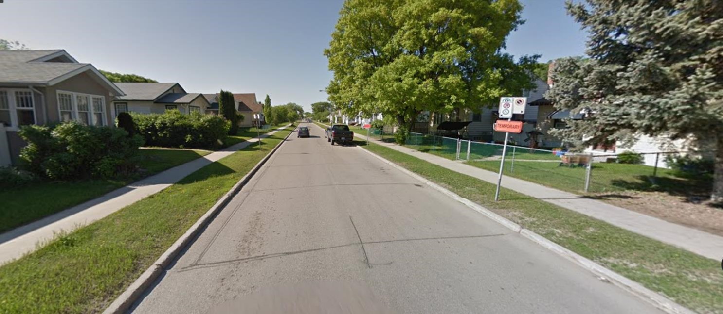
For part three of my West End Street Oddities series, I cross Portage Avenue into Wolseley and head down to the south end of Dominion Street at the Assiniboine River where you will find a barricade across the street. Beyond it are three houses at street level on the east side, (numbers 445, 443, and 441) and where the roadway should be is a sharp drop down to a greenspace that requires stairs to access.

At first, I thought this might be a remnant of some old civic infrastructure project. Perhaps the foundation of a pedestrian bridge across the river that never materialized or the site of a long-gone storm sewer surge tank that regulated water flow into the river.

It turns out that this is the work of Mother Nature.

The 1959 Slump


June 10, 1959, Winnipeg Free Press

The riverbank at the foot of Dominion Street was eroding through the 1950s. In 1959, a major slump badly damaged the end of the street and the two properties nearest the river.

The house at 443 Dominion, second from the end, had most of its front yard torn away exposing the underground sewer and water pipes that led to it. Things were worse at number 441 which lost almost its entire front and side yard and its connecting pipes were ruptured.

The city did some emergency repairs. The exposed and damaged sewer pipes were patched and a hose was run from the nearest fire hydrant to provide number 441 with water. A wooden trestle was run between the two properties to give number 441 access to the sidewalk that ran to Wolseley Avenue.

The condition of the street and the debate over the fate of the properties made the news in June 1959. 


September 18, 1959, Winnipeg Free Press

Legally, the city said it had no responsibility for the properties. Riverbank erosion is a natural occurrence and riverside landowners were on their own when it came to resolving the damage that resulted from it.

Some city councillors argued that the city had a moral responsibility and for weeks the city's Public Works committee discussed a range of remediations from rebuilding the lost land to expropriating and tearing down the most impacted properties.

Things came to a head in September 1959 when an expropriation notice was prepared for 441 Dominion, though it didn't make it to a City Council meeting for final approval.

Another hearing about the properties was held by the committee on September 23, 1959 where the lawyer representing the property owner at number 441 threatened to sue the city if it didn't provide sewer and water to the property. That drew the ire of some committee members and he apologised for his comments. 

Another delegation was Mrs. Ann Tucker of 443 Dominion who asked if she could be allowed new underground sewer and water pipes connected to her house via her neighbour's front yard at her own expense. The committee approved her request.


July 24, 1984, Winnipeg Free Press

The Dominion Street issue disappeared from newspaper coverage after that September meeting and the details of how the issues were resolved is not clear.

The two properties still stand, so they very likely got their new sewer and water connections through the front lawn of number 445. The street was closed off with a barricade between number 447 and 445 Dominion, and a stairway was built to lead down to the greenspace. The city also built a wooden retaining wall near the properties to prevent further bank slippage.

The story next appeared in the news in July 1984 after the city's Works and Operations department announced that it would fund a new engineering study of the area as some had claimed there was continued slippage and signs that the 1959 retaining wall was beginning to disintegrate.

The owner of number 441 appeared before the Works and Operations committee and told them that in the late 1960s, he had to install a new concrete foundation under his house as the stone foundation was being pulled apart. He thought the the city should compensate him for the work he had done.

There was no news coverage about the findings of the engineering report but the city's Board of Commissioners did prepare a report for City Council in November that stated there were no signs of new slippage on the land when historical aerial photographs were compared to modern ones. The report concluded that the city should stick to its long-standing policy and "assume no liability for bank stability problems on privately owned lands."

Two of the property owners again threatened possible legal action for damages in December 1959 and after that, the issue disappeared from newspapers.

The 1913 Street Extension


February 16, 1899, Brandon Sun

Why did such a major slump happen only at the end of Dominion Street and not at neighbouring streets?  I went back in newspaper archives to the time the street was created to find an answer.

Dominion Street from Portage Avenue to the Assiniboine River ran adjacent to Happyland amusement park and was once home to the huge greenhouses and growing fields of  Jubilee Nursery. The company was created in the late 1890s by Robert Alston who sold the company, but not the land, to Ueberrhein and Smith in 1904.


July 7, 1906, Winnipeg Tribune

In the summer of 1906,  Alston began marketing fifty-foot lots in "Caragana Place" which comprised of a "Dominion Street" with a back lane on either side.

This was a land speculation scheme as a formal roadway would not have existed this early and city utilities such as sewer, water and electricity were not in place. Lots would have been sold to speculators and builders to hold onto until they were ready to develop. At that time, they could flip the lots or build houses on them.

Many of the homes on Dominion Street were built between 1909 (nearer Portage Avenue) and 1912 (nearer Wolseley Avenue).

June 13, 1913, Winnipeg Free Press
(right click, view image in new tab for larger version)

The section of Dominion Street between Wolseley Avenue and the Assiniboine River was not in the original plans for Caragana Place nor was it on the original city survey. Instead, it was intended to have several houses facing Wolseley that backed onto the river, just like the rest of the neighbourhood to the west of it. 

It wasn't until a company called the West End Realty and Building Co. bought the land and in 1913 convinced the city to let it extend Dominion Street to the river.

In the long classified ad above, the company noted that it had permits to build houses on 26 lots on Dominion Street that year and that "In removing the earth from the excavation of the foundation of these houses we are able to fill a large portion of the bank (at the end of Dominion Street), giving it an additional 30 feet which is being parked. This will be held securely and the river bank protected from future erosion by means of a retaining wall which is now being built."

It goes on to say that the park would be gifted to the city.


May 31, 1913, Winnipeg Free Press

A related Winnipeg Free Press story on May 31, 1913, noted that the land was already being cleared and graded to make way for the street extension and that piledriving had begun for the retaining wall at the river's edge.

The park at the end of the street was expected to have benches, lights, and a metal staircase down to the water's edge at the developer's expense and would be gifted to the city once the work was done. In exchange, the city agreed to cover the cost of running sewer and water to the extension.

The story concluded that once completed, "... Dominion Street (will be) one of the finest residential streets in the city and one of the few streets with direct access to the river, while it will be the only street on which provision has been made for the public in this manner."

The houses were constructed and the park was completed. It is likely this extension failed and helped bring about the slump of 1959.

The Greenspace


It is unclear what became of the park and river access created by West End Realty and Building Company in 1913 but it is likely that it disappeared over time. This was discovered in a series of news stories about the fencing off of private land adjoining the park in 1980.

According to the stories, by the early 1970s there wasn’t much of a park or riverfront access at the foot of Dominion Street.

Izzy Asper, the provincial Liberal leader at the time, was elected as the MLA for Wolseley in 1971 and saw the need for a proper park at this location He donated what he thought to be around $8,000 of his salary to “make it a park” by having the land graded, grass added, and a staircase built to the river’s edge. For its part, the city agreed to add benches and mow the grass on the site.

In 1974, Asper brokered a $1 per year lease agreement between the city and the residential property owner on the east side of the city land to create a wider greenspace. When the lease deal ended in 1979, the new owner did not want to continue with the public access and in the spring of 1980, a fence was built along the property line that stopped 30 feet short of the river’s edge.

Asper left office in 1975 but was interviewed by the Winnipeg Tribune during the 1980 fence brouhaha. He said, "Frankly I am quite upset. That was my only tangible monument to my tenure as MLA for Wolseley."

August 22, 2019, CBC Winnipeg

Fast forward forty years and there is a case of déjà vu when the fencing off of the same private land adjacent to the city greenspace returned to the news. 

According to this CBC report, a city spokesperson said that the city had reached another $1 per year lease agreement with the property owner from 1986 to 2009. When it expired, the property owner did not want to renew it and nine years later built the fence.


May 30, 1906, Winnipeg Tribune

Related

-  The house at 441 Dominion Street is hard to see even at street level, but luckily it is currently for sale. See pictures inside and out in this Realtor's listing or in this video.
- West End Street Oddities Part 1: How many lanes does Arlington Street have?
- West End Street Oddities Part 2: Why does Valour Road have no boulevard trees?

Tuesday, 17 May 2022

West End Street Oddities - Part 2: Why does Valour Road have no boulevard trees?

© 2022, Christian Cassidy

This is the second post in my series on West End Street oddities.


Google Street View


A question I often get asked is why are there no boulevard trees on Valour Road when those around it are your typical West End streets lined with century-old elms?

I've never found a definitive reason in a newspaper story or history book, but I am fairly certain that the answer has to do with a streetcar line that never materialized.

Here's a deep dive into Valour Road's early development....

Delayed Development?

May 26, 1906, Winnipeg Tribune

One of the theories people suggest to me is that Pine Street, as it was called until 1925, was developed later or differently than surrounding streets and somehow missed out on the city's original round of boulevard tree planting. This does not appear to be the case.

Both Pine Street and Ashburn Street were marketed as the "Argyle Park" suburb by the Argyle Land Company between 1905 and 1907.

This was not an unusual practice for a land company to buy a sliver of land, market it under a cool name, then begin selling off lots before city surveyors came in to formally lay out the street and add services such as water, sewer, sidewalks and boulevards. Some lots would have been built on right away but most would have sat empty until these services were run and the lots or the houses on them would fetch a lot more money.

June 30, 1906, Winnipeg Tribune

The city got around to installing boulevards and sidewalks on Pine Street from Portage to Ellice in 1907 and from Ellice to Sargent in 1912. The addition of water and sewer mains were announced in 1908 and likely built the following year. The timing of this infrastructure work on Pine is similar to the streets around it.

It would have after water and sewer were run that the city would have moved in to plant boulevard trees. I could find no mention in local papers as to why streets such as Spruce, Clifton, Ashburn and Strathcona got them and Pine did not.

The early development of the street can be traced in editions of the Henderson street directory.

1907: There were 6 homes, all between Portage and Ellice.
1908: There were 34 houses, all but 5 between Portage and Ellice.
1911: There were 56 homes, all but 5 of them between Portage and Ellice
1914: There were 98 homes, all but 7 of them between Portage and Ellice
1916: There were 130 homes, all but 15 of them between Portage and Ellice.

There was a also spike in home construction immediately after World War I into the early 1920s.

The West End's Public Transportation Woes


As the West End grew, so did the need for public transportation. There were long-established east-west street car lines running along Portage, Sargent, and Notre Dame, but not many options to bring people north or south onto those lines.

Sherbrook Street had streetcar service since 1897 and in 1908 a single car line was added on Arlington Street from Notre Dame to Portage. This was to have been part of a central beltway stretching from the city limits at West Kildonan into Fort Rouge but never materialized, (you can read more about that here.)

By the time Arlington Street was added to the streetcar system, there were already calls to add another cross street further west with Pine Street being one of the top contenders.


March 6, 1924, Winnipeg Tribune


The expansion of public transportation in the area had to wait until the early 1920s because of the economics of running the streetcar service.

Winnipeg's streetcar system was operated by a private entity called the Winnipeg Electric Railway Company. Because of the enormous cost involved to build each kilometre of new streetcar line, it was not interested in running them down residential streets where it would take decades to recoup their costs. Even for the city, which was constantly demanding expanded service on major routes, service along residential streets was a low priority.

In 1923, the streetcar company agreed to extend Sargent Avenue's streetcar line from Dominion Street west to Pine Street. Instead of turning onto Pine, a wye or turnaround would be built so that the car could travel back down Sargent, (that wye is where the Valour Road Memorial Plaza is now.)

To appease the city and residents who were hoping for more, it proposed a bus service along Pine Street from Portage to Sargent. The streetcar company was given permission to use buses as feeders for streetcar lines in Wolseley in 1918 and by the mid-1920s had about a dozen short routes in operation.


October 18, 1923, Winnipeg Tribune

The provision of bus service would take care of another long-standing bugbear of Pine Street residents - the fact that their street was never paved. It was a muddy, rutted mess for much of the spring and the streetcar company said its condition was so poor that it would not run a bus unless it was graded and asphalted. The city agreed and in late July 1924 began work on the section from Sargent to Portage.

Buses began running on Pine Street on the morning of October 20, 1924, with service every 15 minutes from 6 a.m. to midnight.

Pine Street never got its streetcar service and the Sargent line was never extended any further west.

In 1938, Sargent Avenue's streetcar line was converted into Winnipeg's first trolley bus line with vehicles that used the overhead electrical wires of the streetcar system but ran on rubber tires.

Streetcar service was discontinued city-wide on September 19th, 1955.


The Sargent - Valour trolley, ca. 1940s (City of Winnipeg Archives)


Conclusion


Unlike neighbouring streets, Pine Street was left without boulevard trees and unpaved after water and sewer mains were run in 1909. This, coincidentally, was the year after the West End's first north-south streetcar line was added on Arlington Street with Pine often mentioned as the next cross street in the loop.

If this was a proposed streetcar route it would not have made sense to pave it as they would only have to tear it back up to install tracks.

As for boulevard trees, they would have been a problem given how narrow Pine Street was. To add streetcar service, the city may have wanted to widen the street slightly to add a narrow lane down the middle, similar to Arlington Street. If kept at its original width, trees would surely have interfered with the poles and overhead wires needed for such a service.

See my other tree-related posts and columns:
The stories that Winnipeg's trees can tell Winnipeg Real Estate News
First 'city gardener' chose elm trees that line boulevards Winnipeg Free Press

Friday, 30 April 2021

West End Street Oddities - Part 1: How many lanes does Arlington Street have?

© 2021, Christian Cassidy

This is the first in a series about West End Street oddities.

How many lanes IS it?

If you've ever driven down Arlington Street between Notre Dame and Portage avenues you will have noticed that it either has four very narrow lanes or two really wide ones. Which one is it and what's up with the strange width?

The answer to the first question that it is just two lanes wide. There are no painted lines, so the two curb lanes are parking lanes, though parking is never allowed in the northbound lane.

One clue pointing to this comes just south of the intersection with Notre Dame where the first 100 metres or so has painted lines and, as the big yellow sign indicates, it narrows down to just one lane.


December 18, 1907, Winnipeg Tribune

Why the strange width?

The reason for the strange width goes back over 110 years when a single street car line ran down the centre of this section of Arlington Street.

In August 1907, the Winnipeg Electric Railway Co., the private company that ran the city's streetcar service, filed plans with the city engineer to install a single streetcar track down the middle of  Arlington Street from Portage Avenue to Notre Dame Avenue.

The Arlington line was a feeder loop to the existing Sherbrook line. Cars ran from Sherbrook Street west on Notre Dame Avenue to Arlington Street, then south on Arlington Street to Portage Avenue, then west back to Sherbrook Street.

Construction of the track and installation of the poles was underway in October and by December the wires and other hardware were being fitted. Service on the Arlington line began around January 14, 1908.

William Scott, the city's streetcar engineer, told the Board of Control at their February 1908 meeting that the Arlington line was operational with two cars in service. They ran ten minutes apart and the route took 20 minutes to complete.


January 21, 1910, Winnipeg Tribune

Arlington Street was chosen as the cross street for the westward extension of the streetcar system over other suggestions, such as Pine Street (Valour Road) or Lipton Street, because some at city hall had big plans to make Arlington Street the "Centre Belt Line".

The idea for another street and streetcar line that would stretch from Selkirk Avenue to Portage Avenue via Arlington first appear in 1906 as a solution to the congestion on Main Street. Over time, the plan evolved into one that would create the longest street in the city with an uninterrupted route from the border of neighbouring municipalities of St. Vital in the south and West Kildonan in the north.

This belt line required two bridges. The first was the Brown and Brant Street Overpass, (what we now call the Arlington Street Overpass), followed by the Arlington Street Bridge that would span the Assiniboine River at the southern tip of Arlington Street.

The city amalgamated Arlington / Brown / Brant streets* under the single name of Arlington Street in 1910 in anticipation of the plan. The single track that ran down Arlington Street between Notre Dame and Portage was considered temporary link and would be replaced by a proper dual track when the beltway was nearing completion.

* Like most of Winnipeg's central streets, Arlington used to change names at Notre Dame (to Brown Street) and after the CPR tracks (to Brant Street). Only Main Street kept the same name throughout. Later, McPhillips Road, which at this time was little more than a winding country road, followed suit.

Section of Hathaway's 1911 Winnipeg map shows Arlington line (Source)

The Centre Belt Line never happened, (you can read more about that below), though the calls to extend the Arlington line further north grew along with the area's population.

In 1914, newspapers mention that the streetcar company received approval to extend the track to William Avenue and create a new loop that included Main Street, William, Arlington and Portage, but it is unclear if or when this happened. The war put a halt to using steel to make streetcar trucks and tracks and most new transportation development ground to a halt.

By the 1920s, the Arlington line does seem to have finally made it to William Avenue, but West Enders were desperate for more public transportation just like every other neighbourhood in the city.

The partnership between the WERCo and the city had always been tense. The city constantly demanded more service and the company was wary of the tens of thousands of dollars in up-front costs required to extend a single line by even a kilometre further down the road.


November 26, 1927, Winnipeg Tribune

The company's way to catch up on the demand for more lines was the motor bus. They were much cheaper becasue no tracks or special hardware was needed and routes could be expanded or changed overnight. (The first bus service was the Westminster route that began service with four buses on May 1, 1918 - you can read more about that here.)

In 1926, the streetcar company requested permission to offer a number of new bus routes and the city agreed. Ten or so buses were put into service in 1927 and another seventeen in 1928. The chassis were imported, but the bodies and interiors of the new 25-passenger buses were built by the WERCo in their shops alongside their streetcars. These late 1920s buses were the first to feature a version of the "lively" orange and ivory livery that stuck around in the city for the next 60-years or so.

One of the earliest streetcar routes to be converted to buses in 1927 was the Arlington line from Portage Avenue to William Avenue and was soon extended Logan Avenue. By the late 1930s, the "Arlington - Mountain" bus route looped from Portage and Arlington to Mountain and Main.


May 3, 1934, Winnipeg Tribune

The tracks were eventually pulled up along the centre of Arlington Street and the track bed filled in. At cross streets, where motorcars would have to drive across the filled sections, the tracks stayed in place until the intersection had to be repaved. In 1934, as seen in the above photo, sections of track still existed at Arlington and Wellington and Arlington at St. Matthews.

Here are a few notable things that happened on the Arlington line in its 20 years of service:

- In June 1914, a break in a wire on the Arlington line near Portage Avenue shut down electricity at the intersection. It blocked traffic along Portage causing a ripple effect throughout the city. At one point there were more than 30 streetcars backed up at Portage and Main awaiting the fault to be fixed.

- Around 7:00 am on Monday December 4, 1916, Mr. and Mrs. B. Bass of St. Vital were travelling on the car en route to the maternity hospital when she went into labour. The car stopped and passengers disembarked while Mrs. Bass delivered a daughter. An ambulance came to meet them and take them to hospital. The car was out of service for just 20 minutes.

- In 1925, the Arlington line was among the first three streetcar routes to go with "one man cars". This was a controversial move that laid off conductors who went around to collect fares. Passengers now had to enter the streetcar through the front door only and deposit their fare in front of the motorman.

Streetcars and buses were soon joined by a hybrid of the two - trolley buses. They used rubber tires and electrical overhead wires to operated. The first trolley bus line in Western Canada was on Sargent Avenue in 1928.

Streetcar service came to an end in Winnipeg on September 19th, 1955.

A one-time resident of Arlington Street told me that in the 1970s the city proposed a street improvement to widen the street to a full two lanes. because street improvements must be paid for by property owners, the improvement was voted down and the odd number of lanes remains in place to this day.

Why didn't the centre belt line get built?

The centre belt line that would have seen Arlington Street become the second major north - south route in the city after Main Street failed because of the bridges.

A streetcar never ran the length of the Arlington Street Overpass, despite that being one of the major reasons for building it. The gradient was so steep, particularly on the south side where it met busy Logan Avenue, that streetcar operators refused to run down it. After more than a decade of negotiations and even legal battles involving the city, streetcar company, and the streetcar union, a resolution could not be found and the tracks were eventually removed.

When it came time for the bridge in Wolseley, one plan was to take the superstructure of the old Osborne Street Bridge that was being replaced in 1912, down to Arlington Street for reuse. Council got so far as to put out the tender to build the new piers in October 1912.

The project got bogged down as some councillors, perhaps wary of the mess they got into with the Arlington Street Overpass by ordering a bridge superstructure meant to go somewhere else, wanted to explore the cost of building a completely new span.

This delay allowed opposition in the growing residential neighbourhood of Wolseley to take root.

With growing opposition in Wolseley and the realization that a streetcar would never be able to run the entire length of the 'centre belt', the project tumbled down the priority list of important infrastructure projects and eventually disappeared.

That last mention of the bridge came in 1949 when the issue of a Waverley Street bridge across the Assiniboine River was being debated at city hall. Albert Cavanaugh, a retired city superintendent of constriction, appeared as a delegation to argue that Arlington Street was still the most logical place for such a crossing.